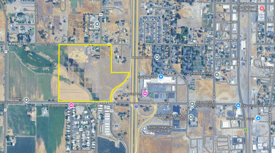
The yellow outline shows the approximately 37 acres proposed for annexation into the City of Orland, located west of Interstate 5 and north of County Road 16/South Street. Graphic by Orland.News via Google Maps.
This post is for subscribers only
You might also like...
22
Jul
Orland City Hall looks to regain its footing after months of upheaval
11 min read
20
Jul
Meeting Prep, July 21: City manager recruiting, an advisory role for Pete Carr, and a consent calendar as long as a CVS receipt
8 min read
19
Jul
Orland council to consider contract with former City Manager Pete Carr as part-time advisor
4 min read
18
Jun
Meeting notes, June 16: Orland names fire chief as interim city manager, adopts new budget
5 min read
14
Jun
Meeting Prep, June 16: Budget adoption, Fire Chief as interim city manager, and a recruitment firm for the permanent search