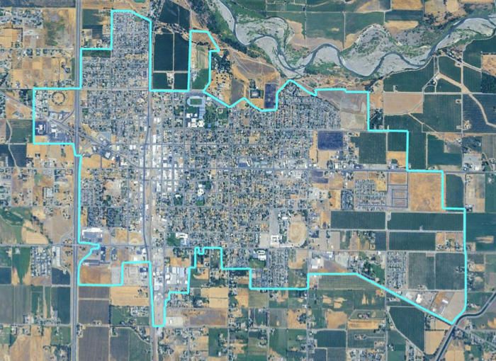
An aerial view of Orland's city limits, as presented by National Demographics Corporation to the Orland City Council on March 3, 2026. The council is in the early stages of dividing the city into geographic election districts for the first time. (Image: DrawOrland.org)
This post is for subscribers only
You might also like...
14
Jun
Meeting Prep, June 16: Budget adoption, Fire Chief as interim city manager, and a recruitment firm for the permanent search
7 min read
07
Jun
For A Better Orland: The city's budget, my dad's quest, and the debt that won't go away
19 min read
03
Jun
Orland council grapples with budget proposal that shifts pension costs to tax measures
5 min read
02
Jun
Meeting Prep, June 2: Interim city manager appointment, new city planner, and the proposed budget
4 min read
01
Jun
Staff proposes to balance Orland budget by using Measures A & J to cover pension costs